Drone Inspection Services
Inspect Energized Equipment From the Air — Not the Bucket
We survey substations and power lines with an FAA Part 107 drone carrying both a 4K camera and a radiometric thermal imager. Crews stay clear of high voltage while we capture closer, sharper data than anyone can reach from the ground — with no shutdown and no bucket truck.
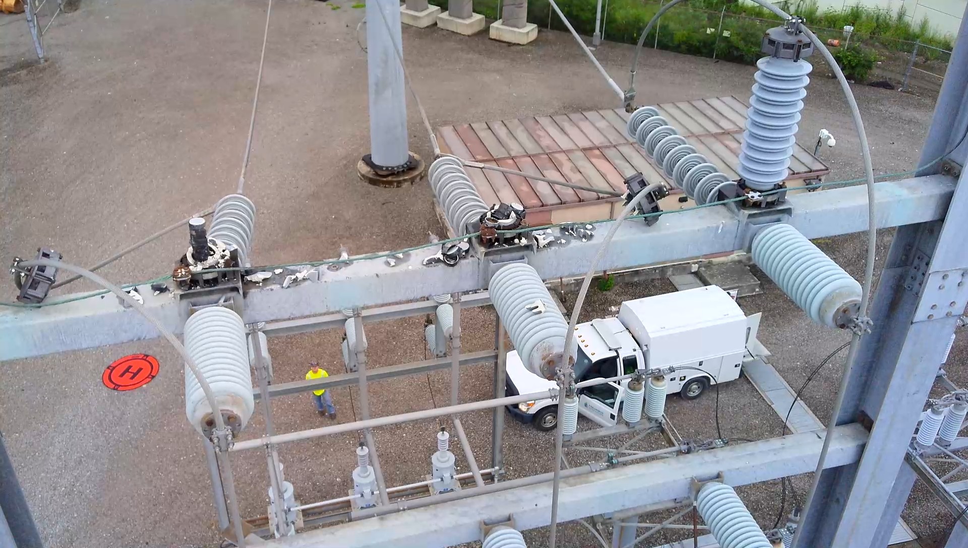
Top-down 4K capture of an energized substation — equipment in service throughout
A Better Vantage Point on Every Asset
Traditional inspections put a technician on foot in a live substation — or in a bucket truck reaching toward energized equipment — just to get a clear view of a connection or the top of a structure. That takes time, staging, and exposure to real hazards.
A drone removes that trade-off. From a safe standoff distance it captures high-resolution visual and radiometric thermal imagery of the same equipment, from angles the ground crew simply cannot reach. We routinely find the root of a hot connection from the air that could not be resolved from below.
Because we fly the same repeatable path at each site, every survey is comparable to the last — so you can watch a connection's temperature trend over time instead of reacting to a failure.
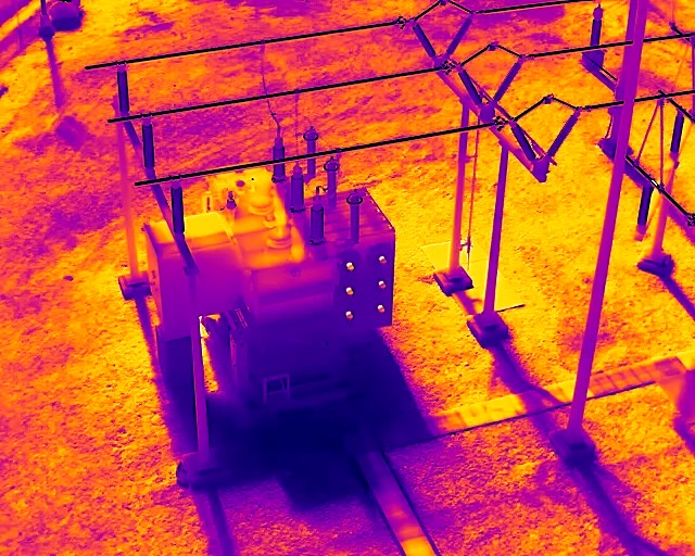
Two payloads, one flight
What We Capture
Each survey collects both thermal and visual data so you see not just that a problem exists, but exactly what and where it is.
Infrared Drone Inspections
A radiometric thermal camera captures the temperature of connections, insulators, bushings, and bus work from the air. Because the drone flies in close, we find the root of a hot connection that is difficult or impossible to resolve from the ground — before it fails.
- Radiometric LWIR imaging of energized equipment
- Bimonthly surveys to catch developing faults early
- Close-range detail the ground crew cannot reach
Visual / Aerial Inspections
4K electro-optical imaging documents structural and mechanical condition — corrosion, damaged hardware, broken insulators, vegetation encroachment, and storm damage — across the whole site, including the tops of structures no one can safely stand on.
- 4K high-resolution stills and video
- Top-down views of structures and dead-ends
- Rapid post-storm and post-event damage assessment
Why It Matters
Improved Safety
The drone keeps our crew out of harm’s way and away from high voltage while capturing better pictures and better data — no climbing structures or walking a live yard to reach an inspection point.
Fewer Bucket Trucks
Aerial access from a drone removes most of the need to stage bucket trucks and man-lifts just to get eyes on elevated equipment, cutting mobilization cost and setup time.
Less Equipment Downtime
Inspections are performed while equipment stays energized and in service. Nothing is de-energized to be seen, so there is no production or reliability impact.
Faster Inspections
A drone survey takes roughly a quarter of the time of an equivalent inspection performed on foot, so more assets are covered in each visit.
Where we fly
Substation & Utility Applications
Substations
Bus connections, disconnect switches, insulators, bushings, transformers, and dead-end structures — imaged from above and up close without entering the yard.
Transmission & Distribution
Line hardware, splices, conductors, and pole-top equipment inspected along the right-of-way, including spans that are hard to reach from the ground.
Post-Event Assessment
Rapid aerial documentation of storm or fault damage on energized equipment, so repair crews know what they are walking into before they arrive.
Sample imagery
What the Data Looks Like
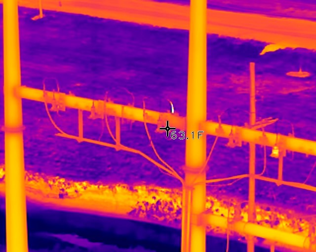
A sample of paired visual and radiometric thermal captures from live substation and line surveys.
Visual / EO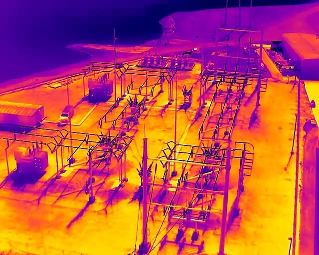 Infrared / LWIRInfrared / LWIR
 Infrared / LWIR
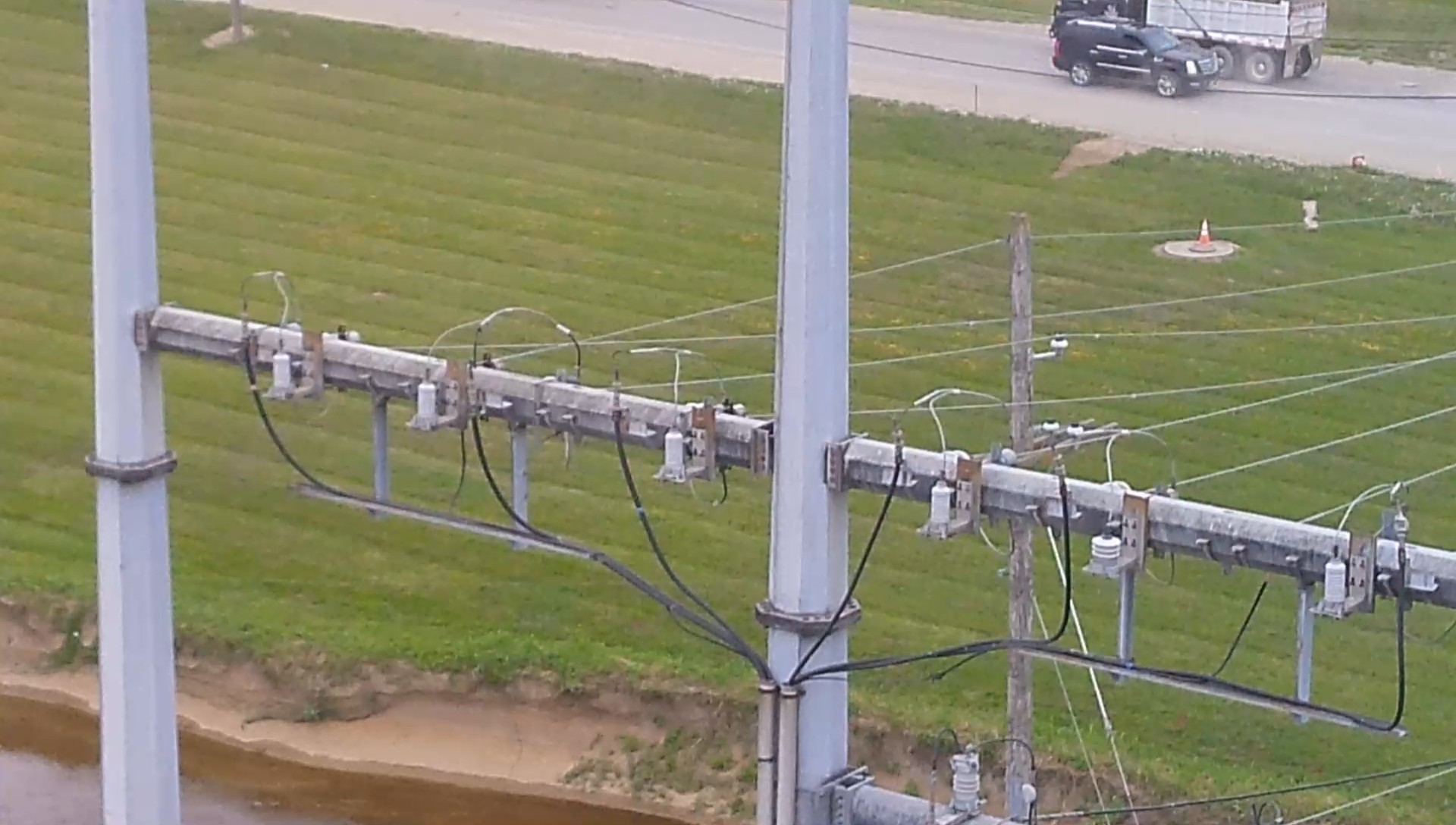 Visual / EO
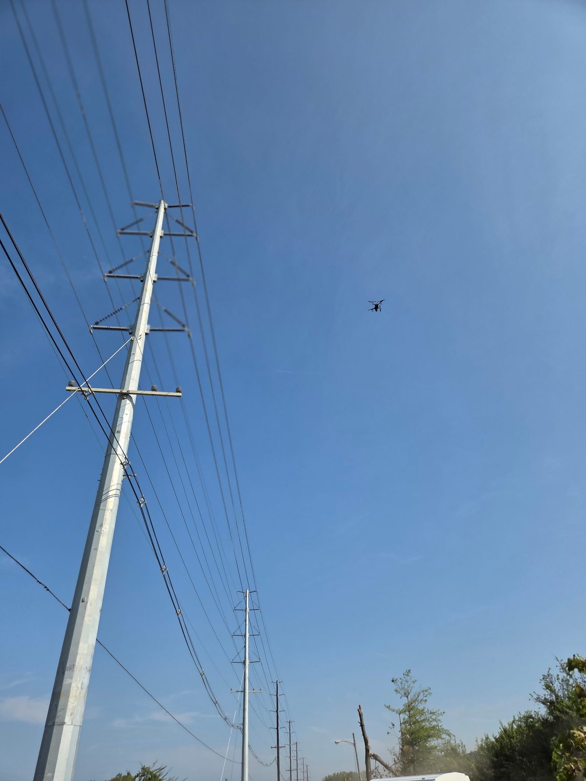 Visual / EO
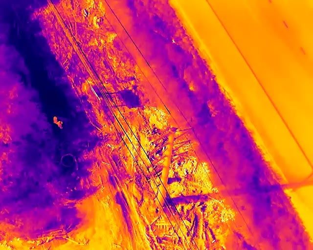 Infrared / LWIR
A sample finding
Catching a Hot Connection Before It Fails
On a routine survey the drone measured a connection running hotter than its neighbors — a classic developing fault. Because we flew in close, we pinpointed the exact connection and its temperature in flight, something the ground crew could not see from below.
That reading becomes a documented, prioritized finding. With the same flight path repeated on the next visit, the client can confirm the repair held and keep trending the connection over time.
FAA Licensing & Compliance
Every flight is conducted legally and safely. Our surveys are flown by an FAA Part 107 certificated Remote Pilot in authorized airspace, with airspace authorization and flight planning completed before we arrive on site.
How we stay compliant
- All flights performed by an FAA Part 107 certificated Remote Pilot
- Operated only in authorized airspace under current FAA rules and regulations
- Flight planning and airspace authorization handled before every survey
- Repeatable, documented flight paths flown at each site for trend comparison
The equipment
Professional-Grade Aircraft & Payloads
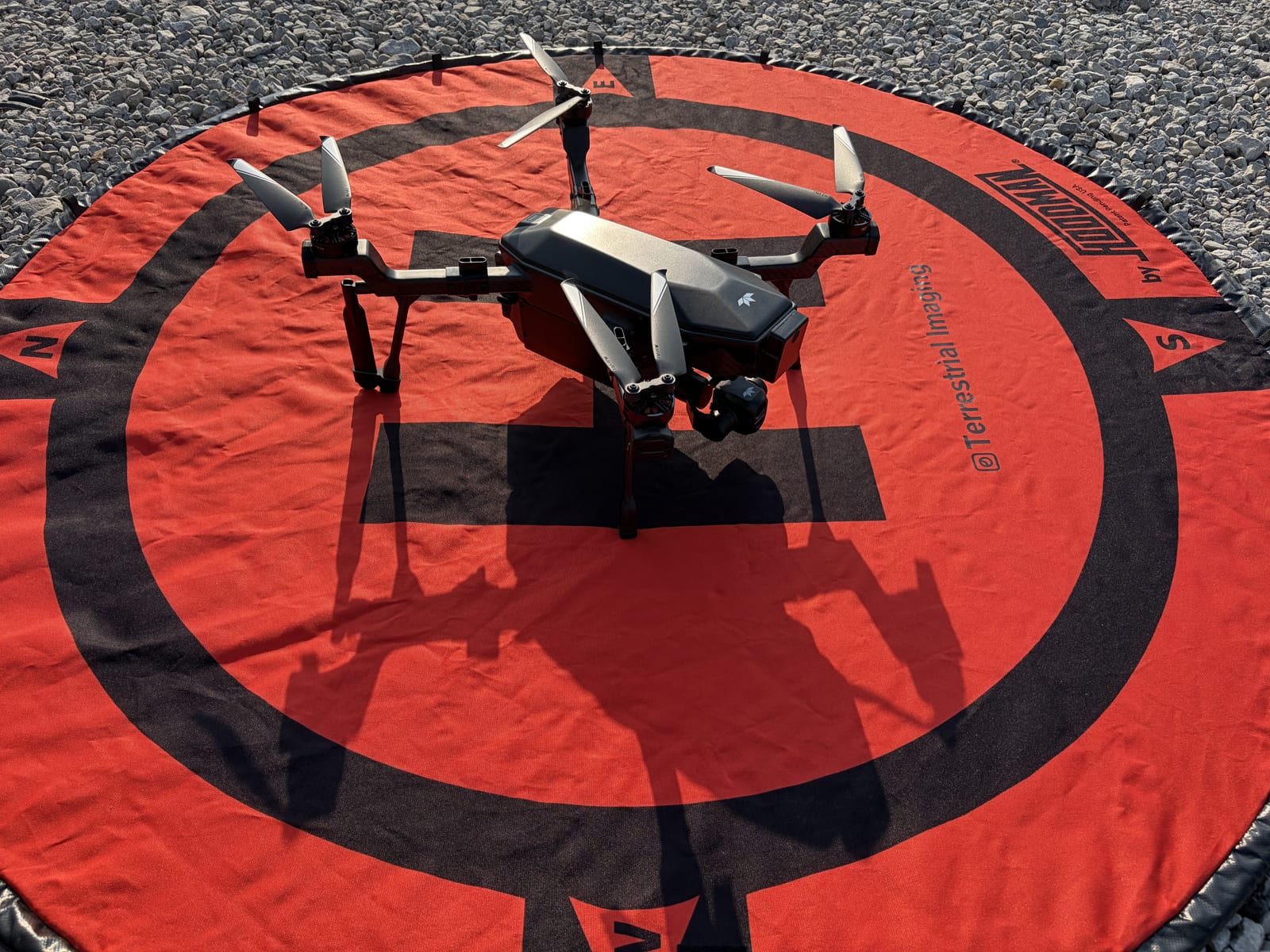
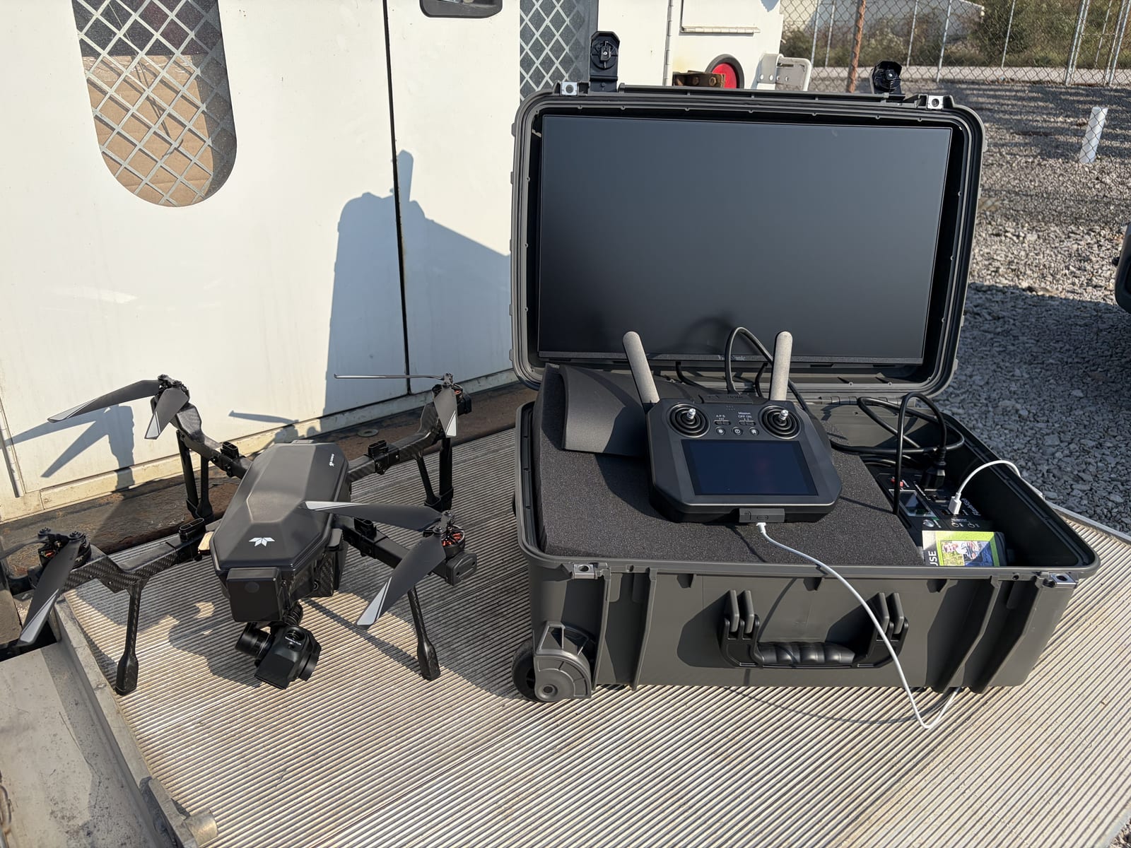
We fly a purpose-built industrial inspection platform carrying both a 4K electro-optical camera and a radiometric thermal imager on a stabilized gimbal — deployed from a self-contained ground station on site.
Part 107
FAA-certified remote pilot
~4x
Faster than on-foot IR inspection
Bimonthly
Infrared survey cadence
4K + LWIR
Visual and radiometric thermal capture
Get eyes on your equipment without putting anyone in harm's way
Tell us about your site and we will scope a drone inspection around your operating schedule — energized, no bucket truck, no shutdown.
Invizions, Inc. — 2519 State Route 61 South, Norwalk, Ohio 44857 · Office 419.663.8621